My friend Dan and I set off on Monday the 7th September 2015 for Mersea Island. Should have taken just over an hour to get there. Dan said you can't get lost its a straight road and is well sign posted. So we didn't bother with the satnav. I didnt pay too much notice as to where we were going Dan had it all in hand. Then I did notice we weren't too far off from the Suffolk border. I turned on my satnav on the phone and we turned around. We eventually headed into Colchester and its many double roundabouts. Hard to follow the satnav when one roundabout is on top of the other and the satnav isnt keeping up. We headed into a road by a university and the road was blocked by a bus only gate. We sat there for a minute trying to work out where we were while several bus drivers drove past laughing. We turned around and satnav said next left we took it and nearly ended up in a wasteland field. Hmm maybe this isn't the way! Anyway we eventually arrive on Mersea Island later than expected by crossing the Strood and parking in West Mersea behind the library. I asked a local which way to the seafront, she said "Its not really a seafront as such,just mud really, but its that way"
After paying £2.50 for a days parking we set off down the road towards the beach.
We walked along Coast Road for a bit where I saw the sign down to the Beach via the Monkey Steps.
The story behind how these steps got their name is unclear, some say there used to be a lookout at the end of the brick wall that was used by the coastguards and that people thought they looked liked monkeys in a cage. Another version is that was actually a cage with real monkeys in it!
We set off walking around the Island anti-clockwise and along the sandy beach. We thought, hope its not sand all the way as this really saps your energy fast!
Mersea Island is an island in
Essex, England, in the
Blackwater and
Colne estuaries to the south-east of
Colchester. Its name comes from the
Old English word
meresig, meaning "island of the pool". The island is split into two main areas,
West Mersea and
East Mersea, and connected to the mainland by the Strood, a
causeway that floods at high tide.
The island has been inhabited since pre-Roman times. It was used as a holiday destination in Roman Britain for occupants of
Camulodunum (
Colchester). Fishing has been a key industry on the island since then, particularly
oysters, and along with tourism makes up a significant part of the island's economy.
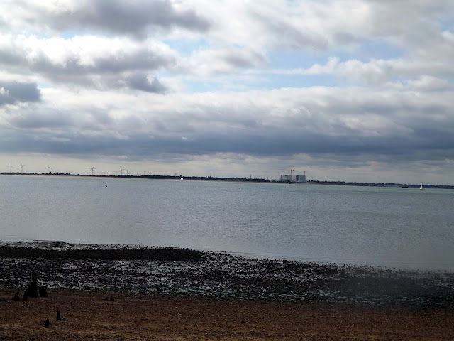 |
| View across the Blackwater to Bradwell Nuclear power Station. |
 |
| Bradwell Nuclear Power Station |
We eventually managed to get on a road that ran parallel with the beach, this was much better.
A little further up was a cafe where we stopped for an ice cream, after waiting for a bit we walked away with the ice-cream and a short break before continuing on.
We now walked past
Seaview caravan park and its many brightly coloured
beach huts and each had an individual stain glassed window.
Further along the beach we now pass
Waldegraves Caravan Site and its fishing lakes. Stayed here once before but that was many years ago now.
We now reach a sign saying the footpath was closed. Well we came to walk the coastline and wasn't about to let a sign stop us. We could see no reason why it was closed anyway and there was a couple walking towards us.
After walking for a bit we soon saw why they have closed the footpath , it was collapsing in several places and was in real bad shape. luckily we could walk next to the concrete.
 |
| A Thames Barge |
We pass by
Coopers Beach Caravan site, a Park Resorts site and down behind the seawall was a old WWII pillbox.
Not a lot of room inside but then over the years it had filled with sand. someone had taken the trouble to place a chair inside. No doubt stolen from the nearby caravan site!
 |
| Thames Barge |
We now pass by
Cosways caravan park and follow on along the coast.
 |
| Wasn't sure that snakes could read! |
|
We now reach
Cudmore Grove Country Park and we stay up on the fossil rich cliffs and go through some woodland.
 |
| Remains of more Pillboxes and fort. |
On the eastern shore of the beach are the remains of a World War II
pillbox. Mersea Island has been strategically important for centuries
and there are also the very faint remains of a Tudor fort here too.
We now reach
Mersea Stone where in Summer months a
foot ferry runs to St Oysth or Brighlingsea.
Phone Harbour Office 01206 302200 or Route One mobile 07981 450169
Depart
from Brightlingsea on the hour between 10.00 and 16.00 (last crossing) calling at Point Clear.
Depart from East Mersea at 15 mins past the hour between 10.15 and 16.15 (last crossing) calling at Point Clear.
Fares (each way):
| Brightlingsea – Point
Clear |
Brightlingsea
or Point Clear –
East Mersea |
| Adults |
£1.00 |
Adults |
£3.00 |
| Children |
£0.50 |
Children |
£2.00 |
| Senior
Citizens |
£1.00 |
Senior
Citizens |
£2.00 |
| Bicycles
& Dogs |
£0.50 |
Bicycles
& Dogs |
£1.00 | |
 |
| View across to Point Clear |
 |
| View across the Brightlingsea |
|
Bateman's tower was built in 1883 by
John Bateman which he used as a
folly for his daughter to recuperate from
consumption; however it may have been intended as a lighthouse as part of a failed plan to expand the port.
 |
| View to Brightlingsea |
We now follow the Northern side of the Island and its many moored yachts and boats.
We reach
The Colchester Oyster Fishery. It is clear how popular oysters are to this island as the beaches are littered with their shells.
Colchester Oyster Fishery can be traced back to Roman times with
oyster shells from the Pyefleet being found in ancient Roman ruins. More
recently the lease on the river was granted to the town of Colchester
by Richard the Lionheart in exchange for supplying labour to build Dover
Castle.
More recently still Colchester Oyster Fishery took over the lease in
1964 and have expanded to be a supplier of not only the finest oysters
but also a wide range of other shellfish and wet fish.
Part of what makes their oysters, both native and rock oysters, so tasty
is that they roam freely on the muddy sea bed down the Pyefleet and the River Colne.
This has resulted in their customer base including many of the finest
London restaurants and hotels such as Le Gavroche, The Ritz, Gordon
Ramsay Restaurants, Nobu amongst many more.
 |
| Never mind the Bullocks............ |
A herd of cows blocked our path and of course it is wise to be wary of them, however clearly they are camera shy as soon as I raised the camera they moved off!
 |
| Black-Tailed Godwits |
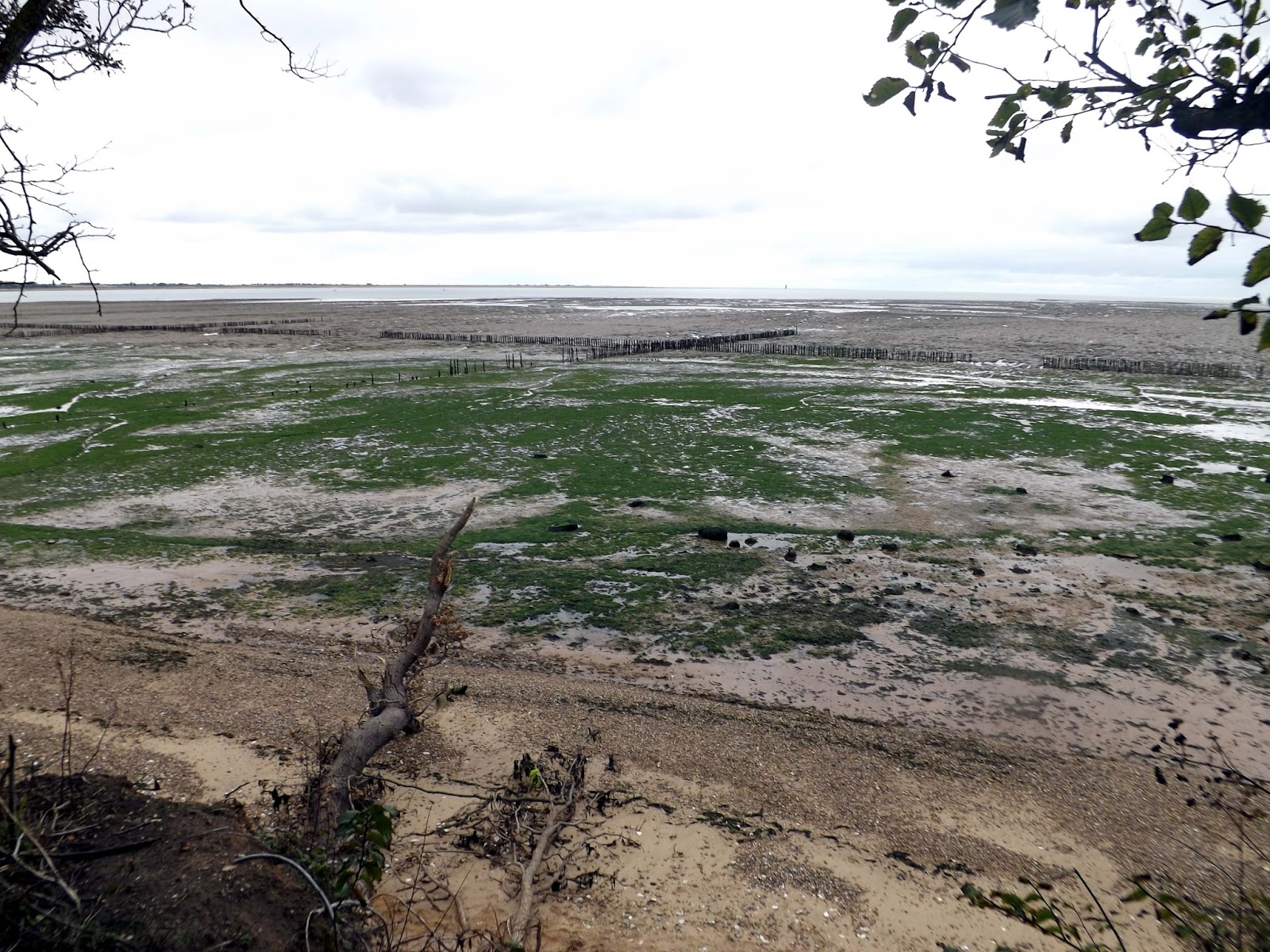
Now is nothing but boring open marshland and the Colne for miles. Legs are starting to ache now.
We stop for a coffee and a rest. Clearly I hadn't rinsed the flask too well, coffee mixed with washing up liquid isn't a good taste.
We eventually reach The Strood. The causeway is part of the B1025 between Mersea and Colchester,
which can become covered during high tides (known as spring tides).
During particularly high tide it is impassable by vehicles including the
emergency services, except for those with high clearance, for over an
hour.
Mersea Island is the most easterly inhabited island in the UK and is
located off the coast to the southeast of Colchester. The current
crossing, or causeway, was first constructed in Roman times.
We had seen The Strood about an hour ago but it never seemed to get any closer. So it was a relief to having crossed it and onto a road heading to West Mersea before taking another footpath.
We now pass
Fen Farm Caravan Park. There are 90 fully serviced static owner occupied caravans on the park,
as well as plenty of room for tourers, tents or motorhomes of any size.
We now reach the marina and pass many yachts again on The Strood Channel.
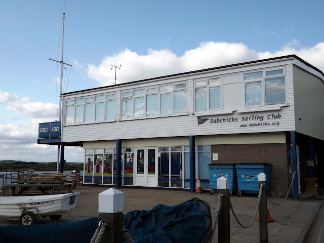 |
| Passing Dabchicks sailing club |
We now reach the Famous
"Company Shed" They are a family run seafood restaurant located in West Mersea,
Colchester, and they have gained a reputation among locals and tourists
alike as being the best restaurant to visit for dishes such as crab,
lobster, fish, mussels, tiger prawns and more. Their extensive eat-in or
take-away seafood menu, combined with their fantastic friendly service,
will ensure that you come back time and time again. All seafood and
alcohol at The Company Shed is sourced locally, whenever possible.
We now reach
West Mersea Oyster Bar, I was tempted to buy something. But Dan isn't keen on shellfish so we gave it a miss.
West Mersea Oyster Bar first opened its doors in 2006 with Michael
Dawson as an expansion to his oyster business. It soon became huge
success.
On April 1st 2010, Chris Avila (Head Chef) & Sel Yuzen (Manager)
took over the ownership of the Oyster Bar with an improved menu &
modernised interior.
The West Mersea Oyster Bar is all about offering quality fresh fish
& seafood dishes & of course some of the best oysters that can
be found in the world. The Colchester Rock Oysters & the Mersea
Native Oysters are bred right here in the creeks of West Mersea &
then processed in the shed that is on the side of the restaurant.
 |
| Houseboat |
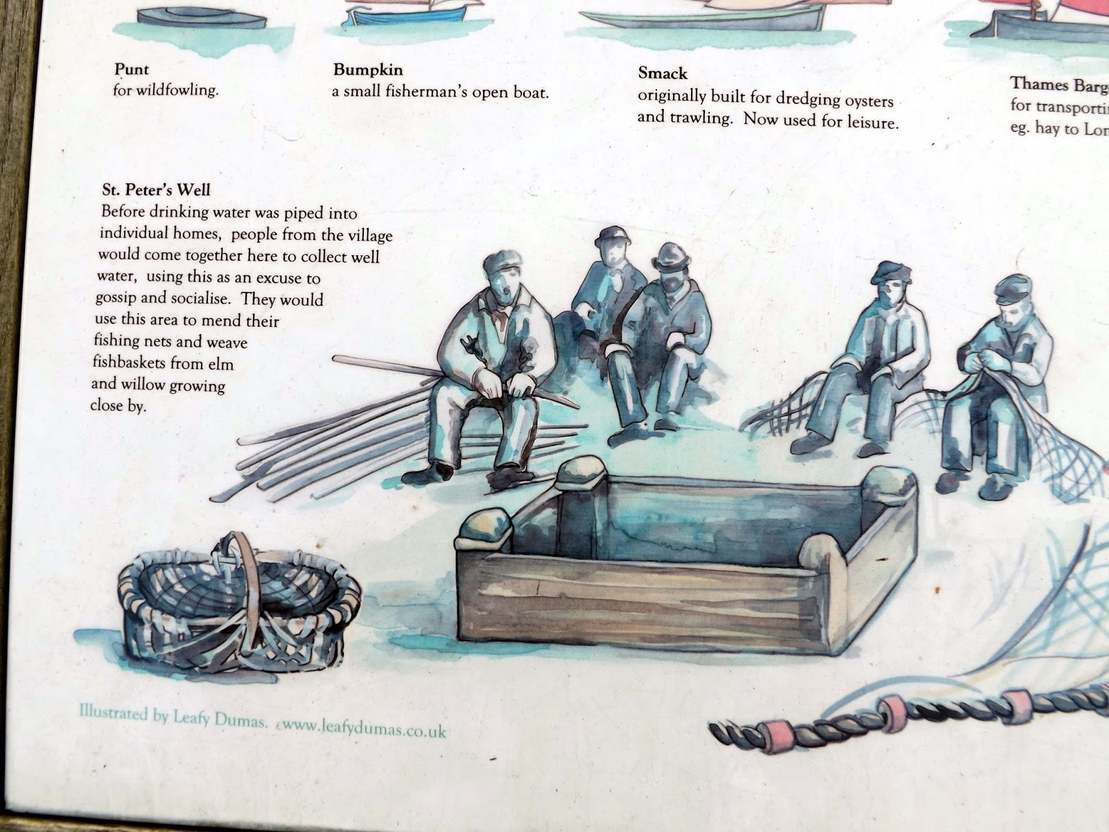
We detour down to St Peters Well. Before water was piped into houses ,people from the village would come together here to collect water ,socialise and gossip.
We head back into town for our fish n chips dinner from
Unique Fish Bar. I would only give this a 4 out of 10.Chips were tasteless and fish was very greasy.
Now it was back to the car for our return journey. All in all a great 14 mile walk but now extremely tired and achy!


No comments:
Post a Comment